File:Txu-oclc-6614383-nk52-6.jpg
Jump to navigation
Jump to search

Size of this preview: 800 × 588 pixels. Other resolutions: 320 × 235 pixels | 640 × 471 pixels | 1,024 × 753 pixels | 1,280 × 941 pixels | 2,560 × 1,883 pixels | 5,000 × 3,677 pixels.
Original file (5,000 × 3,677 pixels, file size: 5 MB, MIME type: image/jpeg)
This is a file from the Wikimedia Commons. Information from its description page there is shown below.
Commons is a freely licensed media file repository. You can help. |
Summary
| Description |
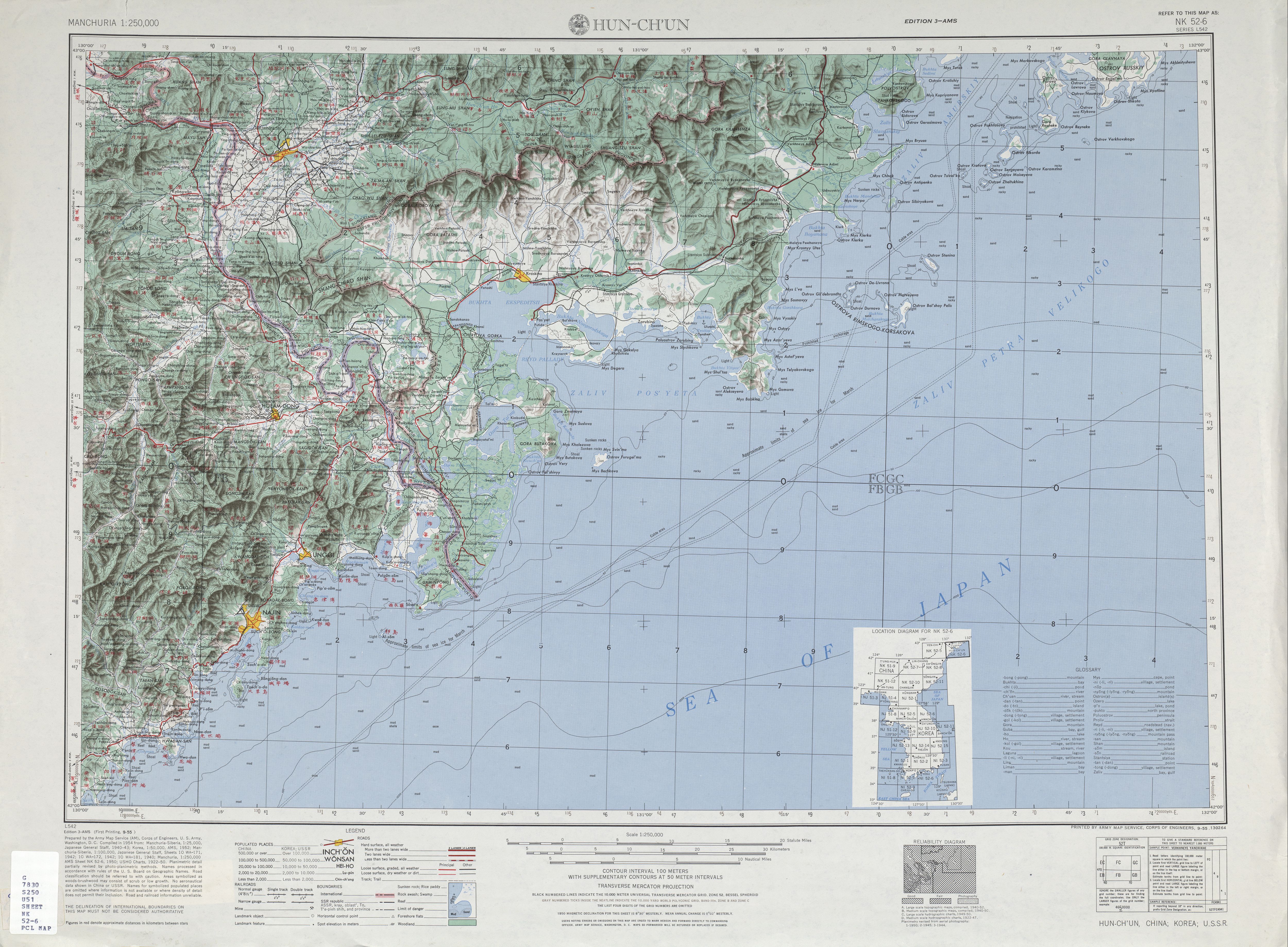
English: NK 52-6 HUN-CH'UN, CHINA; KOREA; U.S.S.R. (5.2 MB) Map of Hunchun (Hun-ch'un) area, in Jilin, China. Error on map: "Ching-hsin-t'sun" for 敬信村 (Hanyu Pinyin: Jìngxìncūn) is more correctly written as Ching-hsin-ts'un (or similar) under the Wade-Giles romanization system; the "t'sun" syllable in "Ching-hsin-t'sun", taken literally, would not indicate any valid sound in Mandarin. |
| Date | |
| Source | Index NK 52-6 ArchivedArchived |
| Author | Army Map Serivce (AM), Corps of Engineers 1954 |
-
 Index Map

Licensing
This image or file is a work of a U.S. Army Corps of Engineers soldier or employee, taken or made as part of that person's official duties. As a work of the U.S. federal government, the image is in the public domain.
|
File history
Click on a date/time to view the file as it appeared at that time.
| Date/Time | Thumbnail | Dimensions | User | Comment | |
|---|---|---|---|---|---|
| current | 01:09, 11 September 2019 | | 5,000 × 3,677 (5 MB) | Geographyinitiative | User created page with UploadWizard |
File usage
The following 3 pages use this file:
Global file usage
The following other wikis use this file:
- Usage on en.wikipedia.org
- Usage on he.wikipedia.org
- Usage on th.wikipedia.org
- Usage on uz.wikipedia.org
- Usage on vi.wikipedia.org