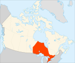
File:Ontario-map.png
Appearance
Ontario-map.png (280 × 230 pixels, file size: 12 KB, MIME type: image/png)
File history
Click on a date/time to view the file as it appeared at that time.
| Date/Time | Thumbnail | Dimensions | User | Comment | |
|---|---|---|---|---|---|
| current | 20:56, 22 June 2005 |  | 280 × 230 (12 KB) | Andrew pmk~commonswiki | optipng |
| 12:16, 24 March 2005 |  | 280 × 230 (14 KB) | Voyager | Map of Ontario Projection: Lambert azimuthal equal-area Geospatial data from: [http://atlas.gc.ca/ The Atlas of Canada], [http://www.nationalatlas.gov/ The National Atlas of the United States] and [http://www.usgs.gov U.S. Geological Survey] Cartograph |
File usage
The following page uses this file:
Global file usage
The following other wikis use this file:
- Usage on de.wikinews.org
- Usage on en.wikipedia.org
- Ontario
- St. Lawrence Seaway
- Dundalk, Ontario
- List of rivers of Ontario
- List of census divisions of Ontario
- Timeline of Ontario history
- Southern Ontario
- List of islands of Ontario
- Eastern Ontario
- History of Ontario
- Music of Ontario
- Southwestern Ontario
- List of lakes of Ontario
- North Shore (Lake Superior)
- Government of Ontario
- Rent control in Ontario
- Northern Ontario Junior Hockey League
- Georgian Triangle
- Geography of Ontario
- Economy of Ontario
- Template:Ontario
- Roads in Ontario
- Category:Tourist attractions in Ontario
- List of mines in Ontario
- List of museums in Ontario
- Bibliography of Ontario
- List of festivals in Ontario
- Rent regulation in Canada
- Talk:Steven Weinstein (philosopher)
- Talk:The White Chapel
- List of museums in Ottawa
- Black Canadians in Ontario
- User:Buffalkill/sandbox/NOJHL teams
- Usage on fa.wikipedia.org
- Usage on fr.wikipedia.org
- Usage on fr.wikinews.org
- Usage on he.wikivoyage.org
- Usage on ja.wikinews.org
- Usage on ku.wiktionary.org
- Usage on nl.wikivoyage.org
- Usage on pl.wikipedia.org
- Usage on ro.wikipedia.org
- Usage on ru.wikipedia.org
View more global usage of this file.


