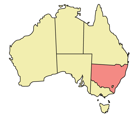
File:New South Wales locator-MJC.png
Jump to navigation
Jump to search
New_South_Wales_locator-MJC.png (563 × 476 pixels, file size: 12 KB, MIME type: image/png)
File history
Click on a date/time to view the file as it appeared at that time.
| Date/Time | Thumbnail | Dimensions | User | Comment | |
|---|---|---|---|---|---|
| current | 22:48, 30 December 2005 |  | 563 × 476 (12 KB) | Snowdog | Map of Australia highlighting New South Wales Made in Adobe Illustrator by Martynam and released under the GFDL Category:Maps of Australia |
File usage
The following page uses this file:
Global file usage
The following other wikis use this file:
- Usage on ar.wikipedia.org
- Usage on ckb.wikipedia.org
- Usage on cs.wikipedia.org
- Usage on cy.wikipedia.org
- Usage on de.wikipedia.org
- Usage on en.wikipedia.org
- User:99of9
- User:Stixpjr
- User:Nomadtales
- East Richmond railway station, Sydney
- Penshurst railway station, Sydney
- Punchbowl railway station
- Narrandera Airport
- User:SamJohnston
- User:Martyman/My Images/Maps
- Glenreagh Mountain Railway
- User:Grogan deYobbo
- RAAF Base Glenbrook
- Dochra Airfield
- Allandale railway station, New South Wales
- Cemetery Station No. 3 railway station
- Cemetery Station No. 2 railway station
- Rookwood railway station, Sydney
- User:RuthlessOne
- Palm Beach Water Airport
- Broken Hill railway line
- Stroud Road railway station
- Transport Construction Authority
- Lismore Airport
- Broken Hill Airport
- Coonamble Airport
- Griffith Airport
- Lightning Ridge Airport
- Bourke Airport
- Cobar Airport
- Walgett Airport
- Merimbula Airport
- Narrabri Airport
- Parkes Airport
- West Wyalong Airport
- Clyburn railway station
- Delec Platform railway station
- Hope Street Platform railway station
- Enfield South Platform railway station
- Cochrane railway station, Sydney
- Oaklands railway line, New South Wales
- Hay railway line
- Rankins Springs railway line
- Burcher railway line
- Tocumwal railway line, New South Wales
- Tumbarumba railway line
View more global usage of this file.


