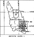
File:Map of Espiritu Santo.jpg
Jump to navigation
Jump to search
Map_of_Espiritu_Santo.jpg (485 × 530 pixels, file size: 80 KB, MIME type: image/jpeg)
File history
Click on a date/time to view the file as it appeared at that time.
| Date/Time | Thumbnail | Dimensions | User | Comment | |
|---|---|---|---|---|---|
| current | 15:07, 5 April 2021 |  | 485 × 530 (80 KB) | Zoozaz1 | Uploaded a work by United States Bureau of Yards and Docks from Building the Navy's Bases in World War II, Volume II with UploadWizard |
File usage
The following page uses this file:
Global file usage
The following other wikis use this file:
- Usage on en.wikipedia.org

