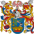
File:HUN Somogy megye COA.svg
Jump to navigation
Jump to search

Size of this PNG preview of this SVG file: 598 × 599 pixels. Other resolutions: 239 × 240 pixels | 479 × 480 pixels | 766 × 768 pixels | 1,022 × 1,024 pixels | 2,043 × 2,048 pixels | 2,501 × 2,507 pixels.
Original file (SVG file, nominally 2,501 × 2,507 pixels, file size: 419 KB)
File history
Click on a date/time to view the file as it appeared at that time.
| Date/Time | Thumbnail | Dimensions | User | Comment | |
|---|---|---|---|---|---|
| current | 07:17, 29 October 2016 |  | 2,501 × 2,507 (419 KB) | Chris die Seele | User created page with UploadWizard |
File usage
The following page uses this file:
Global file usage
The following other wikis use this file:
- Usage on als.wikipedia.org
- Usage on ar.wikipedia.org
- Usage on az.wikipedia.org
- Usage on ban.wikipedia.org
- Usage on be-tarask.wikipedia.org
- Usage on bg.wikipedia.org
- Usage on bn.wikipedia.org
- Usage on ca.wikipedia.org
- Usage on cs.wikipedia.org
- Usage on de.wikipedia.org
- Komitat
- Komitat Somogy
- Vorlage:Infobox Komitat in Ungarn
- Kleingebiet Balatonföldvár
- Kleingebiet Nagyatád
- Flaggen und Wappen der Komitate Ungarns
- Kleingebiet Csurgó
- Kleingebiet Lengyeltóti
- Kleingebiet Kaposvár
- Kleingebiet Siófok
- Kleingebiet Fonyód
- Kleingebiet Barcs
- Kleingebiet Marcali
- Kleingebiet Tab
- Vorlage:Navigationsleiste Kleingebiete im Komitat Somogy
- Kleingebiet Kadarkút
- Kreis Siófok
- Vorlage:Navigationsleiste Kreise im Komitat Somogy
- Kreis Tab
- Kreis Barcs
- Kreis Csurgó
- Kreis Kaposvár
- Kreis Fonyód
- Kreis Marcali
- Kreis Nagyatád
- Grenze zwischen Kroatien und Ungarn
- Vorlage:Infobox Komitat in Ungarn/Doku
- Karád
- Usage on en.wikipedia.org
View more global usage of this file.